Welcome to Indiecad
Australia’s Premier Surveying and 3D Survey Experts!
Indiecad provides surveying and 3D laser scanning services for architects, designers, engineers, property managers, and construction companies. Our advanced technologies capture comprehensive data to help you maximize your building and infrastructure projects. With our expertise, you can efficiently plan, design, construct, and manage assets from start to finish.
Our Services
Land Surveying Solutions
Help me legally measure and record my land parcel and its terrain and building features.
Whether you’re involved in property development, renovation, purchase or facing legal disputes, our Land Surveying services provide you with accurate surveying and drafting services. We streamline property documentation and legal compliance to ensure clarity and security in property transfer, ownership and modifications.
Laser Scanning, Drafting & 3D Modelling Solutions
Efficient as-built measurements and detailed documentation for building and project management.
In Architecture, Construction, Refurbishments and fit outs we offer As-Built and 3D Surveys then drafting 2D & 3D models including Floor Plans, Elevations, Reflected Ceiling Plans, and more. Our services provide you with updated as-built documentation and precise 3D DWG and Revit models for efficient design, planning, and optimized space utilization.
Aerial Drone Surveys
Broad-scale, accurate digital terrain models and analysis.
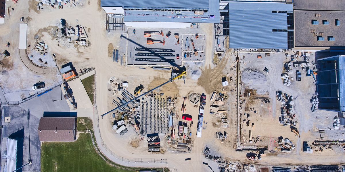
Our clients take advantage of our expertise in Aerial Drone Surveys, LiDAR surveys and Photogrammetry services for land use and planning, surveying, environmental management, volume calculations and more. We offer high-resolution survey-grade deliverables and versatile digital assets for dependable insights.
Get a Quote For Your Project
Let’s create stunning deliverables
Servicing Sydney, Melbourne and Brisbane, Indiecad are tech heads with the latest surveying, scanning and geospatial technology at their everyday disposal.
Focused on using innovative methods to deliver tried and tested digital data, Indiecad cut down the long- timeframe, high-cost of more traditional methods – producing quality-assured, data-driven insights set to revolutionise the way we view, manage and modify the as-built environment.
Accurate Boasting a full suite of the latest technology, Indiecad leave nothing to chance. Taking up to 1 million observations per seconds using laser scanning technologies, Indiecad is able to scan and capture entire streetscapes in minutes, even convoluted spaces with irregular angles or confined spaces in complete darkness. The result is seamless and accurate data capture on time, every time.
Creative Bring your designs to life and offer your clients a complete understanding of your projects with the range of high quality and immersive architectural and site visualisation content by Indiecad. From photorealistic renders, to virtual reality, and everything in-between, Indiecad can create immersive experiences of your design before construction even begins.
Cost effective With a focus on using state-of-the-art technology to cut down time and increase accuracy, Indiecad use the latest scanning and reality capture technology to conduct site surveys and create custom deliverables for your needs. Cost-effective, with a short turnaround time, Indiecad deliverables can save your projects time, resources and costs.
Years Established
Completed Projects
Refer our video to see an example bringing a real life structure into Augmented Reality.
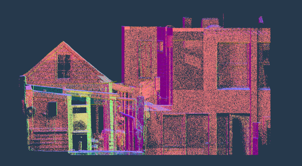
Spaces are scanned, then we process the data (millions and millions of points with precise x,y,z coordinates) and create 2D plans, 3D models and AR experiences.
No missed measurements, incomplete data and or unreliable critical measurements – means the long days of disto and tape are gone with no more site revisits to capture missed site information.
Frequently Asked Questions
What makes Indiecad stand out in land surveying and terrain analysis?
Indiecad are experts in land surveying and laser scanning offering specialized services tailored to architects, designers, engineers, property managers, and construction companies. Our expertise in Go-to-Market and Jobs to be Done strategies ensures efficient achievement of your goals with accurate data and legal compliance.
How do Land Surveying Solutions help in property development and legal disputes?
Land Surveying is essential for building and planning applications providing accurate site context, project planning and legal clarity for all parties. This is essential for those involved in property renovation, development or facing legal disputes, ensuring clarification of property boundaries.
What are the benefits of Feature (Topographic) Surveys for AEC projects?
Topographic or Feature Surveys are crucial for construction, civil and infrastructure projects and environmental assessments. These surveys provide accurate and comprehensive data about the existing conditions of the site, including elevation changes, contours, water bodies, vegetation, buildings, utilities, and other features. This understanding is essential for effective project planning and design.
How do Digital Terrain Models assist in construction, urban planning and infrastructure projects?
Digital Terrain Models (DTMs) are crucial for construction, urban planning, and infrastructure projects, providing detailed terrain representations that aid in site analysis, design optimization, visualization, and risk management, enabling informed decisions and streamlined workflows.
What is the importance of Cadastral Surveys in property ownership?
Cadastral or Title Boundary Surveys are vital for property ownership as they confirm title boundaries, ownership rights, and land configurations, preventing disputes and enabling confident transactions. This prevents disputes, encroachments, and conflicting claims, ensuring confidence in property transactions and enabling owners to use and develop their land without legal uncertainty.
What are the advantages of Laser Scanning for commercial projects?
Laser Scanning offers significant advantages for commercial projects by providing accurate, efficient, and comprehensive data capture, improving design and planning processes, reducing costs, enhancing collaboration, and promoting safety.
How do Site Layout/MasterPlan services benefit architects and urban developers?
How do we assist with Heritage Buildings in historical building restoration?
The laser scanning of Heritage Buildings is essential for restoration specialists and architects involved in historical building preservation. Our non-invasive data capture ensures accurate restoration while preserving the historical value of your assets.
How do Engineering Surveys aid in structural analysis and renovation planning?
What are the applications of Aerial Surveys in agriculture and environmental conservation?
Aerial Drone Surveys, LiDAR, and Photogrammetry services are invaluable for site planning, environmental conservation and engineering. They offer high-resolution data and versatile applications for accurate terrain analysis.
What is the role of Site Context and Analysis in strategic planning and environmental impact studies?
Site Context and Analysis services provide comprehensive site analysis and understanding that is essential for urban planners and developers in land-use planning and environmental impact studies. They offer the insights needed for informed decision-making and environmental consideration.
Testimonials
Indiecad guys are truly an expert in laser scanning.
Awesome suite of services for the building industry! Chris is fantastic at identifying our needs and putting forward the right solution.
Chris knows his stuff when I comes to photogrammetry. Hey created a superb model of my new development. I have been using this highly accurate model to impress prospective clients.
Great work Chris!


