Broad-scale, efficient and accurate terrain and site analysis.
Aerial Surveys
Unlock powerful insights with Indiecad’s aerial survey solutions. Our advanced LiDAR and photogrammetry capabilities provide high-resolution 2D and 3D spatial data for a wide range of industries and applications. From land surveying and construction planning to environmental monitoring and topographical analysis – our tailored spatial services deliver the accurate data intelligence you need. Whether your project spans vast acreage or long corridors, rely on Indiecad’s proven drone survey expertise to gain a competitive edge through quality-assured data and insights.”
Aerial Surveys and Terrain Mapping
Precision in geospatial mapping and topographical analysis.
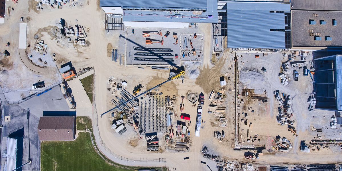
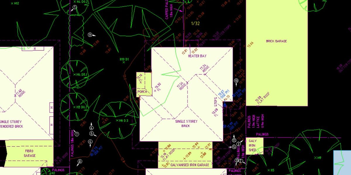
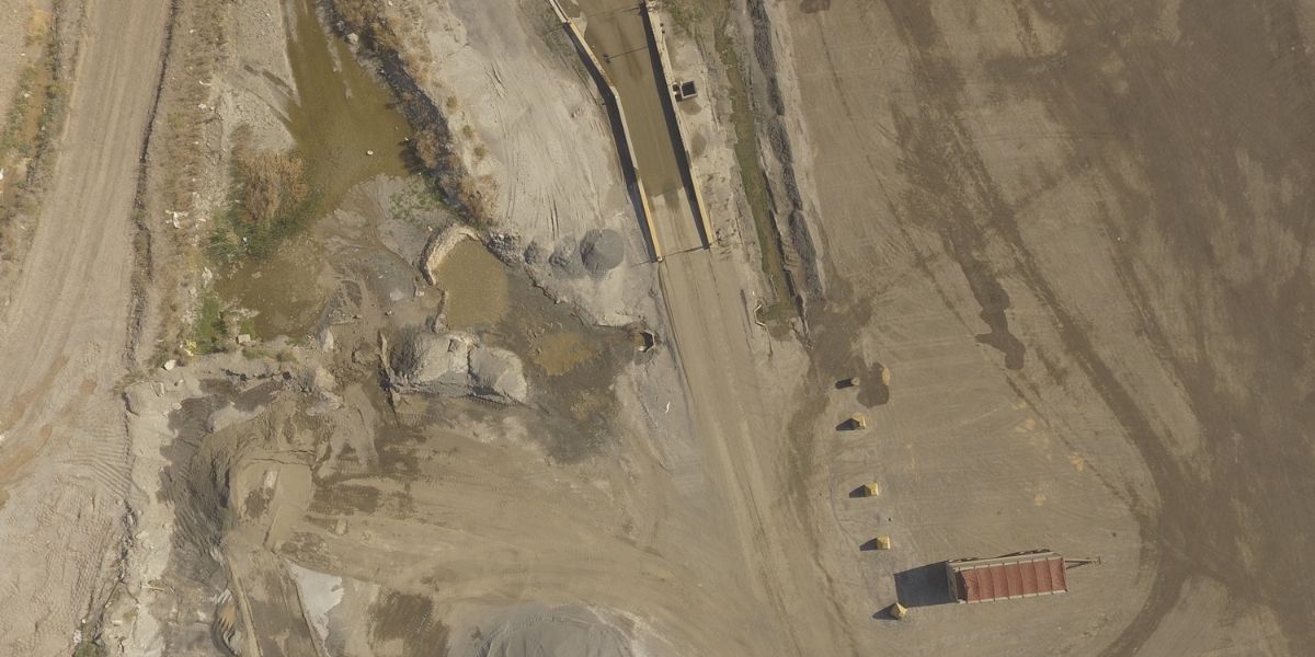
Ideal for land management, landscape architecture, agricultural planning, construction and environmental conservation, our aerial drone surveys offer clients a large-scale perspective for efficient terrain analysis, delivering broad-scale, accurate terrain, planimetric and feature analysis.
LiDAR and Photogrammetry
Detailed building and structural insights.
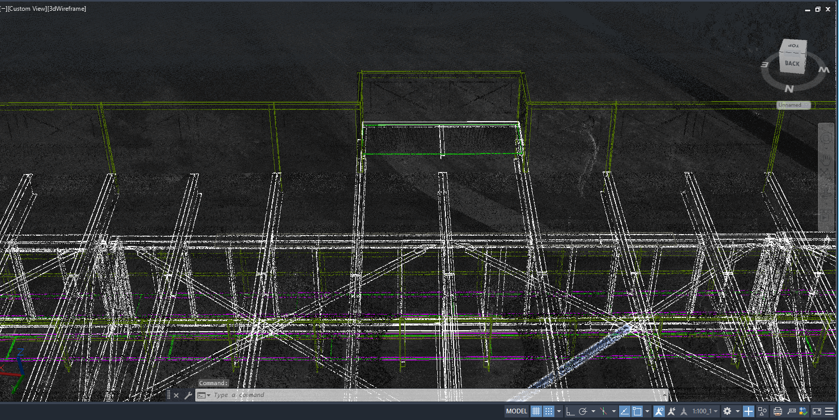
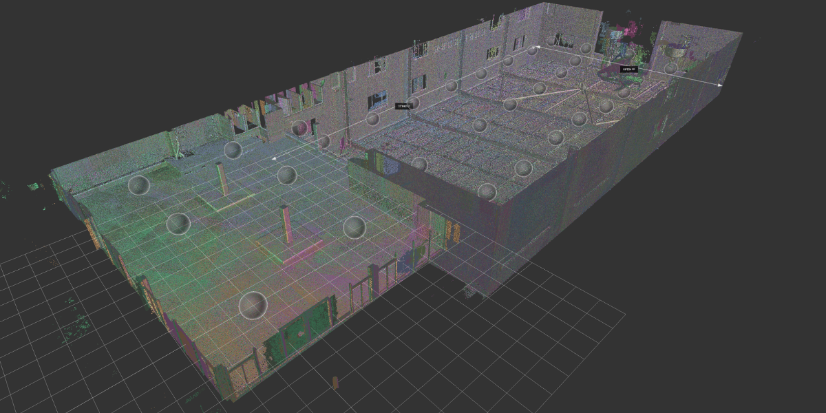
Providing high fidelity 3D models from terrestrial laser scanning (TLS) combined with Photogrammetry for varied structures, buildings, towers and landscapes, our LiDAR and photogrammetry services are perfect for surveyors, civil engineers, infrastructure maintenance and asset monitoring, and other applications requiring high-resolution point cloud data and versatile laser scanning applications.
Farm Surveys (Large Land Areas)
Advanced insights for efficient land management.
Agriculturalists and landowners seeking land optimisation, development and planning can trust our Large Land Area (Farm) Surveys. Our mapping services provide survey-grade contours, draining and slope analysis for advanced insights and efficient land management.
Corridor Mapping (Road & Rail)
Enhancing public safety and infrastructure planning.
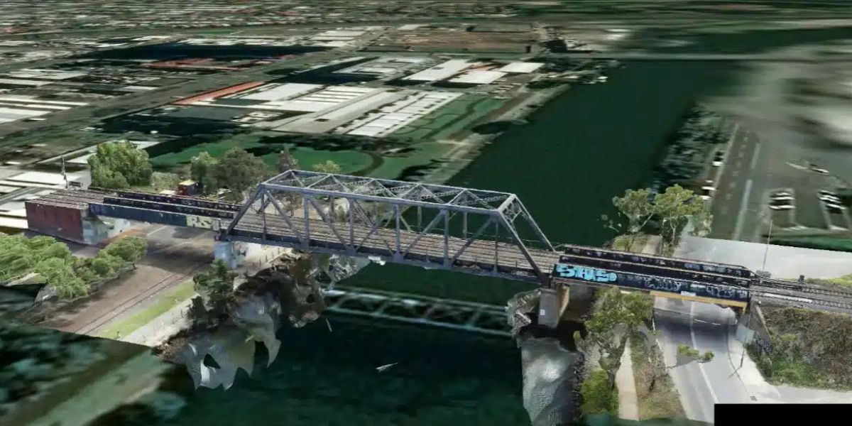
Civil engineers, construction and urban planners benefit from our Corridor Mapping services for construction, transportation planning and utility mapping. We enhance project management, public safety and infrastructure planning with our precision corridor mapping services including planimetric extraction, contours and volume calculations.
Facade and Roof Maps (2D and 3D)
Detailed structural insights for safety compliance, maintenance and remediation.
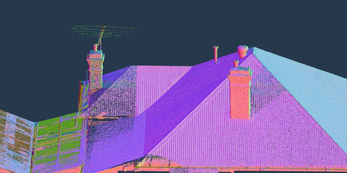
Architects and construction companies seeking building inspection and architectural planning can rely on our Facade and Roof Maps. We provide detailed as-builts, plans and engineering drawings from LiDAR and photogrammetry.
Neighborhood Context Plans and Streescapes
Neighbourhood-centric planning and development.
Architects, urban planners and developers involved in urban development and building projects can count on our Neighborhood Context Plans and Streetscapes. Our services enable community-centric planning and support development applications with 3D streetscapes and neighbourhood maps.
Precise 3D Building Models and Tours
Interactive exploration of architectural concepts and existing conditions.
Architects, interior designers and fitouts benefit from our Precise 3D Revit Models for improved design concepts, drawings, virtual tours, and 360 interactive tours. We bring your architectural concepts to life with engaging and interactive mediums.
Site Context and Analysis
Strategic planning with comprehensive site analysis.
Architects, builders and developers seeking land-use planning and design compliance can rely on our Site Context and Analysis services. We provide the necessary insights of the subject site and surroundings for informed decision-making, ensuring building code compliance and planning considerations.
Why Choose Indiecad’s Aerial Services?
✓ Efficiency, Precision, and Insights for Your Projects: Indiecad’s surveying services are tailored to meet the specific needs of professionals across various sectors, from agriculture to development planning, ensuring your projects not only meet but exceed expectations.
✓ Accurate Terrain and Site Analysis: Our Aerial Drone Surveys, LiDAR, and Photogrammetry deliver precise terrain and as-built data, crucial for land management and planning and asset management, enabling informed decisions based on reliable data.
✓ Efficient Farm Management: With advanced insights from our Farm Surveys, agriculturalists and landowners can achieve land optimization and effective irrigation, managing large land areas with greater efficiency.
✓ Public Safety and Infrastructure Enhancement: Civil engineers and construction urban planners find our Corridor Mapping services invaluable for design engineering, transportation and utility planning, enhancing project management, efficiency and infrastructure reliability.
✓Reliability in Construction: Our Facade and Roof Maps provide architects, building owners and construction companies with updated as-built drawings and assessment of existing conditions, crucial for ensuring building safety compliance and structural integrity.
✓ Strategic Urban Development: Neighborhood Context Plans and Maps support architects, urban planners and developers in community-centric planning, while our Site Context and Analysis services offer comprehensive insights for strategic land-use planning and feasability studies.
✓ Dynamic Architectural Visualization: Architects and designers benefit from our 3D Building Models, bringing architectural concepts to life for engaging design proposals and presentations.
Partner with Indiecad for our range of services that combine cutting-edge technology with a commitment to precision, quality and efficiency. Let’s achieve your goals together with expertise that makes a difference. Discover our services and transform your projects today.
Call For a Quote:
(03) 9018 5323
Frequently Asked Questions
What makes Indiecad stand out in land surveying and terrain analysis?
Indiecad are experts in land surveying and laser scanning offering specialized services tailored to architects, designers, engineers, property managers, and construction companies. Our expertise in Go-to-Market and Jobs to be Done strategies ensures efficient achievement of your goals with accurate data, quality assurance and legal compliance.
How do Land Surveying Solutions help in property development and legal disputes?
Land Surveying is essential for building and planning applications providing accurate site context, project planning and legal clarity for all parties. This is essential for those involved in property renovation, development or facing legal disputes, ensuring clarification of property boundaries.
What are the benefits of Feature (Topographic) Surveys for AEC projects?
Topographic or Feature Surveys are crucial for construction, civil and infrastructure projects and environmental assessments. These surveys provide accurate and comprehensive data about the existing conditions of the site, including elevation changes, contours, water bodies, vegetation, buildings, utilities, and other features. This understanding is essential for effective project planning and design.
How do Digital Terrain Models assist in construction, urban planning and infrastructure projects?
Digital Terrain Models (DTMs) are crucial for construction, urban planning, and infrastructure projects, providing detailed terrain representations that aid in site analysis, design optimization, visualization, and risk management, enabling informed decisions and streamlined workflows.
What is the importance of Cadastral Surveys in property ownership?
Cadastral or Title Boundary Surveys provide clarity and security of property boundaries and confirm encroachment in property ownership. They are essential for landowners, ensuring property rights and legal documentation for property disputes.

